Impress employers and recruiters.
Choose from hundreds of resume examples.

Impress employers and recruiters.
Choose from hundreds of resume examples.
Tailor your resume to this Director, Surveys and Geomatics role.
Rezi rewrites your resume against Infrastructure Ontario's job description. Free.
Tailor your resume to this Director, Surveys and Geomatics role.
Rezi rewrites your resume against Infrastructure Ontario's job description. Free.
Don't guess if your resume is good enough.
See how it scores against the Director, Surveys and Geomatics posting at Infrastructure Ontario — free, in seconds.
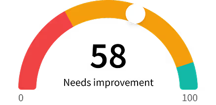
Don't guess if your resume is good enough.
See how it scores against the Director, Surveys and Geomatics posting at Infrastructure Ontario — free, in seconds.
About the Role
Infrastructure Ontario (IO) is seeking a Director, Surveys and Geomatics to provide subject matter expertise and leadership, overseeing the operational management of land survey and geomatics services. This role is both technical and operational, requiring hands-on work at times, and involves managing internal and external client expectations, service standards, product management, and the strategic development of the GeoPortal.
Responsibilities
- Manage the provision and delivery of specialized GIS, mapping, survey, and conveyance services.
- Provide technical advice and recommendations, supervise the design and implementation of standards, and ensure quality control.
- Develop and maintain partnerships with government ministries and agencies, secure new clients, and promote GeoPortal products and services to generate non-tax revenue for the Province of Ontario.
- Oversee the management of GIS systems and related service providers, recommend technological upgrades, and ensure data quality, access, security, and integrity.
- Prepare and manage procurement documents, negotiate licenses, and oversee service providers to ensure compliance with service level expectations.
- Manage the coordination, preparation, and control of the business unit’s budget.
- Develop and provide training in surveys, title search, and GIS systems for staff and users.
- Set performance standards, review staff performance, and participate in recruitment.
- Lead new approaches to geomatics and GIS systems to incorporate their usage throughout corporate decision-making.
- Lead the development of new GIS guidelines, specifications, and standards that set a benchmark for the industry and improve data integration and accessibility.
- Support the rollout of IO’s Underground Infrastructure Mapping Initiative.
- Manage and maintain IO’s GIS information database and search application called GeoPortal.
Requirements
- University or college degree in Land Surveying, Geomatics, Physical Geography, Planning, Civil Engineering, or a related field is preferred.
- Many years of experience in surveys and geomatics, with expertise in GIS systems (hardware and software), mapping, and conveyance services.
- Knowledge of data management and technological systems is essential.
- Registered Land Surveyor accreditation would be a strong asset.
- Knowledge of legislation and regulations for professional surveying such as the Surveyor Act and associated regulations is an asset.
- Understanding of data management, application architecture, geospatial data standards and data quality management.
- Strong analytics skills to assess emerging technologies and evaluate business case.
- Experience in consulting or advisory skills to provide technical consulting for geospatial products and strategic guidance would be an asset.
- Experience with Digital Twin platform and mapping implementation would be an asset.
- Experiences in client relationship management and sales would be an asset.
- Strong communication skills to market geospatial products to promote geomatics services would be an asset.
- Experiences in product management and/or data product management would be an asset.
- Experiences in contract management, negotiation skills, financial administrative operations including budget development and asset management would be assets.
- Experience in leading multi-year strategic business program and services plan.
- Experience in planning, coordinating or managing IT procurement would be an asset.
- Strong leadership and team management skills, especially in service operations.
- Excellent communication and presentation abilities.
- Deep understanding of geomatics frameworks and industry practices.
- Experience with developing unit training programs and development roadmaps.
- Knowledge of public sector policies (Ontario or federal) and data governance practices, including data privacy, is an asset.
Skills
- GIS systems (hardware and software)
- Mapping
- Conveyance services
- Data management
- Technological systems
- Analytics
- Consulting
- Advisory skills
- Client relationship management
- Sales
- Communication
- Product management
- Data product management
- Contract management
- Negotiation
- Financial administrative operations
- Budget development
- Asset management
- Strategic business program and services plan development
- IT procurement
- Leadership
- Team management
- Service operations
- Presentation
- Geomatics frameworks
- Industry practices
- Training program development
- Development roadmaps
- Public sector policies
- Data governance practices
- Data privacy
Location
- 1 Dundas St West
Work Type
- Full-time
Experience Level
- Director level
- Many years of experience in surveys and geomatics
Education Level
- University or college degree in Land Surveying, Geomatics, Physical Geography, Planning, Civil Engineering, or a related field
Salary/Compensations
- $139,000 to $160,000
Benefits
- Defined Contribution Pension Plan
- Group Retirement Savings Plan
- Group Tax Free Savings Account
- Comprehensive health, dental, vision, out-of-country care, paramedical services coverage
- Pregnancy and parental leave program with top-up
- $1000 Healthcare Spending Account
- Lifestyle Account
- Support for professional development opportunities
- Coverage for up to two membership and license fees per year
- Access to a suite of virtual healthcare options
About the Company
- Infrastructure Ontario (IO) is an Ontario crown corporation that provides services to modernize and maximize the value of public infrastructure and realty.
- IO has been recognized domestically and internationally for its success with major projects, real estate services, infrastructure lending, commercial projects, and development mandate.
- IO delivers complex, ambitious commercial and land development solutions for the Province and aims to create a connected, modern, and competitive Ontario.
Equal Opportunity
- Commitment to creating a diverse, equitable and inclusive culture that promotes a sense of belonging and represents and reflects the needs of the communities we serve.
- Encourage applications from all walks of life.
- Candidates of any race, gender, sexual orientation, ability, religion, place of origin or any other community are encouraged to apply, and their lived experience will be taken into consideration as applicable to the posted position.
- We encourage you to apply, as you may have other relevant expertise and experience that you can bring to the role.
- Let us know if you would benefit from any accommodations for the selection process, by contacting the Talent Acquisition Team.