Impress employers and recruiters.
Choose from hundreds of resume examples.

Impress employers and recruiters.
Choose from hundreds of resume examples.
Tailor your resume to this Geospatial Frontend Engineer (TypeScript) role.
Rezi rewrites your resume against Orcrist Technologies's job description. Free.
Tailor your resume to this Geospatial Frontend Engineer (TypeScript) role.
Rezi rewrites your resume against Orcrist Technologies's job description. Free.
Don't guess if your resume is good enough.
See how it scores against the Geospatial Frontend Engineer (TypeScript) posting at Orcrist Technologies — free, in seconds.
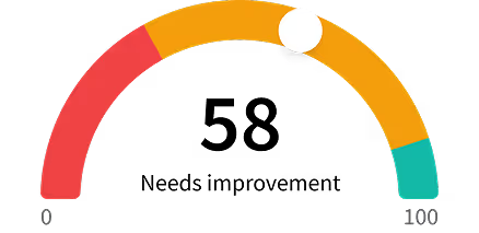
Don't guess if your resume is good enough.
See how it scores against the Geospatial Frontend Engineer (TypeScript) posting at Orcrist Technologies — free, in seconds.
About the Role
Build the web GIS experience analysts use to explore imagery, combine layers, and understand spatial and temporal relationships. You'll work primarily in TypeScript and React, with MapLibre and deck.gl at the center of a highly customised map platform. Your work will range from precise, responsive analyst tools to the rendering and data-loading code that keeps complex maps usable. You'll bring capabilities familiar from desktop GIS tools such as QGIS and ArcGIS Pro into the browser, continuously expanding the map platform's rich feature set while keeping interactions coherent and responsive. You'll extend the existing Sentinel frontend and help establish reusable map and layer components for multiple applications.
Responsibilities
- Develop a reusable map canvas and layer system for raster imagery, vector features, terrain, and analytical overlays, using MapLibre and deck.gl.
- Build layer discovery, grouping, ordering, visibility, opacity, legends, styling, and persistent workspace state, including predictable behavior when sources refresh or fail.
- Implement GIS interactions such as drawing, measurement, spatial selection, feature inspection, coordinate readouts, filtering, and map export.
- Create temporal exploration tools, imagery comparison views, and linked map/table interactions that make complex analytical results understandable.
- Extend mapping libraries with custom layers, controls, picking behavior, and rendering logic. Work below the React component layer when the interaction or performance requirement calls for it.
- Integrate COGs, PMTiles, GeoParquet, and Arrow-based data sources with viewport-aware loading, cancellation, caching, and progressive feedback.
- Profile CPU, GPU, network, and memory usage. Keep panning, zooming, and interaction responsive through sensible level-of-detail strategies, background processing, and controlled layer updates.
- Work closely with UX designers and analysts on cartography, accessibility, and interaction quality. Maintain component examples, browser tests, and performance checks within Sentinel's shared UI system.
Requirements
- Several years building sophisticated production interfaces with TypeScript and React.
- Substantial experience with web mapping or geospatial visualization, using MapLibre, deck.gl, Mapbox GL, OpenLayers, CesiumJS, or comparable tools.
- Experience extending mapping libraries or building reusable visualization components, beyond embedding a standard map.
- Strong understanding of frontend state, asynchronous data loading, browser rendering, and performance profiling.
- Familiarity with WebGL concepts and the practical costs of geometry processing, GPU buffers, large textures, and frequent layer updates.
- Good geospatial fundamentals: projections, coordinate systems, vector tiles, raster imagery, scale, and spatial accuracy.
- Care for cartography and interaction details, including readable symbology, useful legends, keyboard access, and clear loading and error states.
- Clear communication in English and an ability to collaborate with backend engineers, designers, and domain experts.
- Eligible to work in Germany.
Skills
- TypeScript
- React
- MapLibre
- deck.gl
- WebGL
- Cartography
- Custom deck.gl layers
- Shaders/GLSL
- luma.gl
- WebGPU
- Graphics programming
- GeoArrow
- loaders.gl
- DuckDB-WASM
- Web Workers
- kepler.gl
- CARTO
- TanStack Query
- TanStack Store
- TanStack Router
- Tailwind CSS
- Storybook
- Playwright
- Terrain visualization
- 3D visualization
- Imagery band controls
- Temporal animation
- Professional GIS tools
- Military mapping conventions
- MGRS coordinate grids
- NATO APP-6 symbology
- STANAG requirements
- Agentic software development
Location
- Remote-first in Germany
- Berlin
- Frankfurt
- Munich
Work Type
- Remote
- Full-time
Experience Level
- Several years
Benefits
- 30 days of vacation
- Equipment support
- Learning support
- Ownership of components used across the platform
About the Company
- Orcrist builds secure data intelligence software for defense, law enforcement, and enterprise teams.
- Our Sentinel platform combines data integration, AI-assisted analysis, and operational workflows.
- The GEOINT team is extending it with geospatial data services, remote-sensing capabilities, and a web-based common operational picture.