Impress employers and recruiters.
Choose from hundreds of resume examples.

Impress employers and recruiters.
Choose from hundreds of resume examples.
Tailor your resume to this Lead GIS Engineer role.
Rezi rewrites your resume against Electric Power Engineers's job description. Free.
Tailor your resume to this Lead GIS Engineer role.
Rezi rewrites your resume against Electric Power Engineers's job description. Free.
Don't guess if your resume is good enough.
See how it scores against the Lead GIS Engineer posting at Electric Power Engineers — free, in seconds.
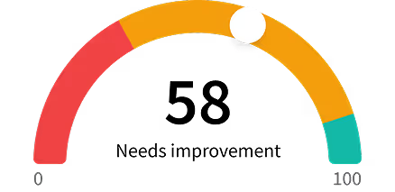
Don't guess if your resume is good enough.
See how it scores against the Lead GIS Engineer posting at Electric Power Engineers — free, in seconds.
About the Role
EPE’s GIS team is looking for a Lead GIS Engineer to serve as the senior technical voice on the team that builds the geospatial data behind our energy intelligence software and consulting deliverables. This is a hands-on technical leadership role focused on architecture, data quality, and raising the technical bar across the team.
Responsibilities
- Set the technical direction for how the GIS team designs datasets, ETL workflows, attribute rules, and geospatial services, and ensure consistent execution.
- Drive the team’s automation roadmap through hands-on design and implementation, including consolidating workflows, automating tasks, refactoring QA processes, and unifying regional geospatial datasets into shared service layers.
- Own the technical definition of data quality for EPE GIS data, including schema standards, attribute rules, and the QA/QC processes that enforce them.
- Own the configuration and operational use of EPE’s GIS environments across the full ArcGIS Online and ArcGIS Enterprise estate, and partner with EPE’s CloudOps team on infrastructure requirements, upgrades, and incident response.
- Own the operational health of EPE’s hosted utility GIS infrastructure, including scheduled data pipelines, Portal management, Utility Network builds, and recurring batch jobs.
- Mentor GIS analysts and engineers through code review, design reviews, pair-programming on hard problems, and technical onboarding for new team members and contractors.
- Facilitate technical syncs and design discussions, surface risks early, and drive the team to credible delivery commitments.
- Serve as EPE’s technical point of contact with Esri on support cases, product roadmap input, and partner program engagement.
- Collaborate with software product teams and consulting practice leads on data requirements, integration design, and delivery planning across U.S. ISO/RTO markets.
- Represent EPE externally at GIS conferences, Esri events, working groups, and client engagements when appropriate.
Requirements
- Bachelor’s degree or higher in GIS, Geography, Computer Science, or a related technical field, or equivalent professional experience.
- 6 or more years of professional GIS engineering experience, including 2 or more years operating as a technical lead, lead engineer, or principal-level individual contributor on a data-focused team.
- Deep, hands-on experience across the Esri stack, including ArcGIS Pro, ArcGIS Enterprise (Portal, Server, Datastore), ArcGIS Online, Workflow Manager, and Enterprise Geodatabase administration.
- Production experience designing and operating Safe FME workflows or equivalent ETL, with the depth to architect, code review, and troubleshoot complex workspaces.
- Strong Python skills for spatial automation, including writing production-ready tools and reviewing teammates’ ETL code.
- Demonstrated experience defining and enforcing data quality, including schema design, attribute rules, QA/QC governance, data lineage, and delivery SLAs.
- Experience scoping and delivering end-to-end GIS projects, including client handoff and professional services support.
- Track record of mentoring engineers, leading design reviews, and raising the technical bar of a team without formal authority.
- Strong written and verbal communication, with the ability to operate effectively across software product teams, executives, and utility-side technical stakeholders.
- Electric utility experience, including transmission and distribution network models, PSS/E familiarity, and exposure to ISO/RTO data structures (MISO, SPP, ERCOT, PJM).
- Experience with Esri Utility Network, including data structures, deployment, and technical configuration.
- Experience standing up or operating GIS automation and orchestration platforms such as FME Flow, Dagster, or Airflow, and CI/CD around spatial data.
- Familiarity with enterprise cloud environments (AWS, Azure, or GCP), particularly as they relate to hosting ArcGIS Enterprise.
- Experience evangelizing or productizing GIS capabilities within a consulting or software firm.
- Experience working with internal software product teams in an Agile or sprint-based environment.
- Background in geospatial portal and web map configuration, including dashboards, apps, and service endpoints.
- Uses AI tools to automate coding, testing, debugging, documentation, and repetitive engineering workflows.
- Reviews AI-generated outputs for accuracy, security, maintainability, and alignment with architecture standards.
Skills
- Esri stack
- ArcGIS Pro
- ArcGIS Enterprise
- ArcGIS Online
- Workflow Manager
- Enterprise Geodatabase administration
- Safe FME
- ETL
- Python
- Spatial automation
- Data quality
- Schema design
- Attribute rules
- QA/QC governance
- Data lineage
- Delivery SLAs
- GIS project scoping
- Mentoring engineers
- Design reviews
- Technical leadership
- Written communication
- Verbal communication
- Electric utility experience
- Transmission and distribution network models
- PSS/E
- ISO/RTO data structures
- Esri Utility Network
- GIS automation
- Orchestration platforms
- FME Flow
- Dagster
- Airflow
- CI/CD
- Cloud environments
- AWS
- Azure
- GCP
- Geospatial portal configuration
- Web map configuration
- Dashboards
- Apps
- Service endpoints
- AI tools for coding
- AI tools for testing
- AI tools for debugging
- AI tools for documentation
- AI tools for engineering workflows
Location
- Remote US or Canada
Work Type
- Remote
- Full-time
Experience Level
- Senior
- Lead
- Principal
Education Level
- Bachelor's degree or higher in GIS, Geography, Computer Science, or a related technical field
- Equivalent professional experience
About the Company
- EPE has partnered with power and energy clients across the globe for over half a century, providing consulting expertise and energy intelligence software solutions for complex engineering and grid modeling challenges.
- As leaders in the renewables space, we are focused on building a modern, secure, and resilient grid.
- Together we can transform the future of energy.
Equal Opportunity
- EPE is an equal opportunity/AA/Disability/Veteran employer.